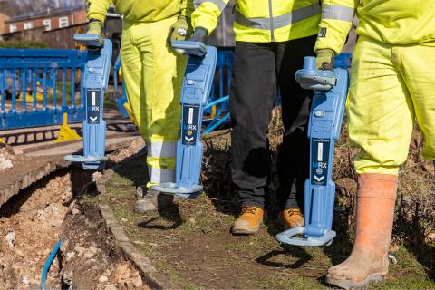
Radiodetection, a leading provider of utility location solutions, today announced the launch of its RF Marker ball (MRX) range; the MRX, MRX G and MRX SG, a line of three innovative locators designed to improve the efficiency and accuracy of utility location. All RF marker locators integrate marker ball detection and utility locating functionality in one device, thereby offering substantial potential to improve efficiency and enhance safety, with the brand new MRX SG offering survey-grade mapping capabilities into a single, integrated device.
"The challenge for utility companies isn't just finding buried assets; it's finding them in an environment that's constantly shifting and evolving," says Thomas Turner, Marketing and Product Director for Radiodetection. "We're talking about cables and pipes laid decades ago, often before accurate records were kept, and the ground itself has changed so much since then. Customers, understandably, need to know the precise location of these buried assets, but the reality is that without reliable equipment, they are often left guessing. That's where utility markers and locators become an absolute essential. Specifically, marker balls have been used for a long time to enable operators to detect telecom or electric vaults, buried splicers, or plastic pipes. Without these marker balls, locating such assets becomes extremely challenging. These markers provide a crucial, direct method for pinpointing the location of infrastructure that would otherwise be difficult or impossible to find. They're critical for minimising the risks associated with locating and managing buried infrastructure."
The MRX range addresses this challenge by providing a comprehensive solution that accelerates the workflow and improves accuracy. With integrated utility and marker ball detection as well as advanced mapping capabilities, the MRX SG locator empowers professionals to work smarter, safer and more efficiently.
The Role of Utility Markers in Accurate Utility Locating
Utility markers, also known as RF markers or Electronic Marker Systems (EMS), play a critical role in locating underground utilities such as plastic pipes, fibre optic cables, and critical points in dense networks. The MRX locators work seamlessly in line with utility markers. These markers are buried alongside underground utilities during installation or maintenance. Each marker is pre-programmed with a specific operating frequency that identifies the type of utility (for example, telecoms, gas, or water). This unique frequency is key to distinguishing between different utility types.
What MRX Suits You?
For professionals needing reliable utility and marker detection, the MRX locator provides a foundation of confidence and efficiency, allowing for precise pinpointing. In challenging urban environments, the MRX G excels, enabling accurate location even in congested areas. For those requiring detailed, digital maps of the buried infrastructure, the MRX SG’s triple functionality allows simultaneous location of buried utilities and utility markers, as well as building accurate, digital maps, therefore enabling informed decision-making for future planning and maintenance.
MRX - An Ergonomic Locator with Combined Functionality:
- Boost confidence with continuous depth estimation and current measurement.
- Accurately identify high voltage power cable where there are multiple high voltage cables buried closely together.
- Easily trace sondes for water and wastewater pipes.
- Extend functionality by using accessories such as clamps, A-frame or stethoscope.
- Effortless data management using RD Manager™ Online PC software for setup, calibration, and data analysis.
MRX G - All MRX Features, plus:
- Verify GPS location with 2-3 m/7-10’ accuracy.
- Navigate congested areas with confidence using Current Direction (CD) technology.
- Automatically stores all locate parameters providing a comprehensive picture of field operations – very useful for supervisors or health & safety personnel.
- Custom frequencies: Up to 5 additional frequencies can be programmed into your locator to match it to the signals found on your target networks.
MRX SG (Survey-Grade) - All MRX G Features, plus:
- Build accurate maps: 1-2cm/sub-inch* accurate mapping.
- Locate and Map: Simultaneously detect and map marker balls and utilities with survey-grade accuracy.
- Map It Your Way: Integrated GNSS, flexible correction services, preferred mobile app and iOS®/Android™ compatibility ensure easy integration into your mapping workflows.
iOS is a trademark or registered trademark of Cisco in the U.S. and other countries and is used under license. Android is a trademark of Google LLC.