

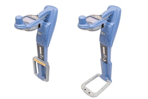


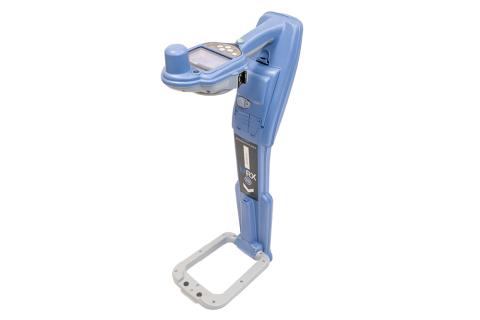

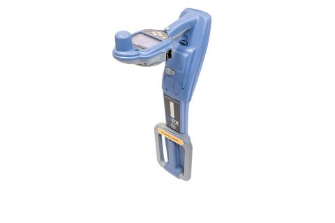


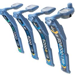
MRX SG Survey Grade Locator
Mapping and Digital Solutions
Precision and Marker Locator Range
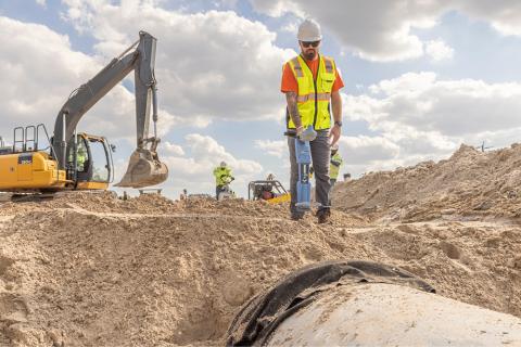
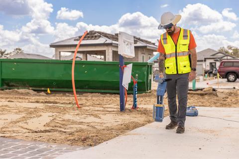
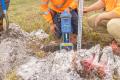
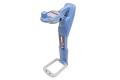
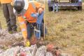
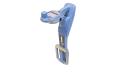
The MRX SG is the most advanced RF (Radio Frequency) marker locator in the MRX range, combining precision line locating, marker ball detection, and survey-grade accuracy in a single, powerful solution. Compatible with both Android™ and iOS®, the MRX SG is built for professionals who need to find buried utilities and marker balls, as well as map them with confidence.
The MRX SG delivers precision locating, high accuracy mapping, and rugged reliability for demanding field environments.
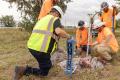
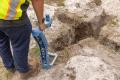
RF Markers
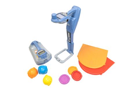
RF markers help locate underground utilities like plastic pipes, fiber optic cables, and critical points in dense networks. There are various types, such as marker balls, near surface, mid-range and full range markers. These RF markers are buried directly above or beside the utility, making them essential for hard-to-find assets. Radiodetection’s RF marker locators have been designed to locate the most common RF markers.
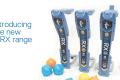
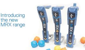
The MRX Range
The MRX range consists of three RF marker locators, designed for those who carry out a wide range of locating tasks. Whether you're tracing utilities, identifying buried markers, or doing both at once, there is an RF marker locator that meets your needs. The MRX is a reliable dual-functionality locator; the MRX G adds advanced capability for locating in congested areas, as well as onboard GPS for integration with digital platforms. The MRX SG offers triple functionality by combining advanced utility locating and marker ball detection with high accuracy mapping in one, powerful tool.
The MRX SG's integrated GNSS (1-2cm/sub-inch*) eliminates the need for a separate handheld GPS device, making surveying more efficient and cost-saving.
*Subject to RTK correction service provider and local conditions.
Choose your preferred mobile app and correction service provider.
Industry-standard file formats to use with your mapping software.
Directly export the data from the locator with RD Manager™ Online
The 4 kHz locate frequency is designed for tracing high-impedance lines such as twisted pair telecoms or street lighting. Since such utilities are often found in areas of dense infrastructure, you can combine 4 kHz with CD to ensure you follow the right line.
The MRX SG is effective for locating a wide variety of underground utilities and offers seven active antenna modes, including:
Peak+ which combines the accuracy of the Peak bargraph with Null arrows, which can indicate the presence of distortion.
Guidance, for rapidly tracing the general path of a buried utility.
Broad peak, can be used to detect and trace very weak signals, for example very deep utilities.
With 21 active locate frequencies spanning from ELF to 200kHz, the MRX SG provides a comprehensive range of frequencies for underground utility location. The available frequencies include a wide range of low, mid, and high frequencies to accommodate various terrains and utilities.
Locate and mapping professionals can optimise their MRX SG for their unique locating challenges by selecting up to 5 custom frequencies between 50Hz and 1kHz, adjustable with 1Hz precision.
This MRX SG supports four distinct sonde frequencies: 512Hz, 640Hz, 8kHz, and 33kHz. This range of frequencies allows for optimal performance in various locating scenarios.
The MRX SG offers five passive locating modes for detecting existing signals without transmitting a signal: Power, Radio, CPS (Cathodic Protection System), CATV (Cable TV), and a Passive Avoidance mode for simultaneous power and radio detection.
Current Direction is a powerful tool that augments the capabilities of pipe and cable locators to help operators pick out their target line from others nearby. Using fundamental properties of electromagnetism, CD allows you to locate your utility quickly and eliminate wasted time following false trails.
Up to 5 additional frequencies can be programmed into the MRX G & MRX SG locators to match them to the signals found on your target networks.
When a signal transmitter can’t be connected, tracing individual underground power lines through complex networks can be a real challenge: conflicting or powerful signals can confuse the operator, or combine to create a broad wash of signal.
With a single key press, you can now utilize the harmonic properties of power signals to establish if a signal comes from one source or multiple cables, then trace and mark their routes.
Combine the MRX with an A-frame accessory to identify and pinpoint insulation sheath faults to within 4" (10cm).
iLOC™ is a wireless link between the locator and transmitter, which allows you to control the locate signal’s power and frequency from up to 1400’ / 450m away. Less time walking and more time locating.
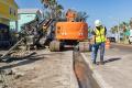
Build a comprehensive inventory of large, buried infrastructure networks.
Minimal additional training for utility operators.
Walk the line once.
Simultaneously map and locate utilities, without compromising on quality.
Locate as accurately as possible, map as accurately as possible.
Software
- Find out more
RD Manager™ Online is the Windows® PC software package for Radiodetection’s Precision and RF Marker locator ranges.
Video
Downloads
Brochure
- MRX SG Survey Grade Locator – Brochure – V1 (2.3MB)
- MRX RF Marker Locators – Family Brochure – V1 (2MB)