LMX® Ground Penetrating Radar (GPR) systems are designed and optimized for utility locating, making it easy to add GPR to your locating workflow. GPR is widely used for utility location and is used for identifying and marking utility mains that are underground.
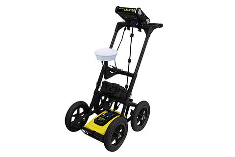
LMX150™ FINDAR® is a compact high resolution, utility locating system for your locating and mapping needs.
LMX150™ FINDAR® GPR complements traditional pipe and cable locators and allows you to locate targets below the surface such as:
- Metal utilities, including pipes and cables
- Non-metallic pipes, including PVC and asbestos cement
- Concrete storm and sewer systems
- Utilities where installed tracer wiring has failed
- Underground storage tanks and drainage tiles
- Septic system components
- Fiber optic cables
- Non-utility structures such as vaults, foundation walls and concrete pads
LMX150 FINDAR Features:
Line Mode
Collect cross-sectional lines for reconnaissance purposes. Identify and focus your search on relevant areas to pinpoint utilities.
Grid Mode
Collect grids to locate utilities in complex areas. Easily collect lines around obstacles within the grid.
3D Depth Slicing
After collecting a grid of data, generate depth slice images on-site. Quickly pinpoint the position and depth of potential utilities.
Field Interpretations
Classify utilities in real time with field interpretations. Use the touchscreen to color-code each utility as it is located.
MapView
Line scans, grids and field interpretations are displayed on the screen in a plan map view (external GPS required).
Screenshots
Easily save screen captures of line data, map views and depth slices as graphic images.
Geo-referenced Output
Display your survey lines, depth slices and interpretations in Google Earth™ and other similar geo-referenced platforms.
USB Data Transfer
Transfer screenshot images and access the GPR data for further post processing.
Visualize, Understand and Report your results with optional EKKO_Project™ PC Software.
With intuitive data visualization tools, you can view your data from different perspectives to gain a deeper understanding, and then quickly and easily produce impressive reports to share your findings.
EKKO_Project™ software allows you to:
- Organize GPR data, photos and other files as a single project (.GPZ file)
- Easily create PDF GPR summary reports of your findings.
- Add interpretations, photos, audio & video to GPR lines.
- Create depth slices with or without a grid.
Please contact your local Radiodetection representative for further details.